Entry No. 46 — the San Francisco file — filed under: mine
Leona Heights Sulfur Mine
The Leona Heights Sulfur Mine is a closed pyrite mine in the Oakland Hills that operated from about 1900 to 1934 to produce sulfuric acid. For decades after its closure, the site left behind toxic tailings that turned Leona Creek a bright, acidic orange. A major remediation project completed in 2015 permanently capped the waste piles, restored the creek, and sealed off the old mine tunnels.
→ Three at a time, never the same twice — explore weird San Francisco
The story
From roughly 1900 until 1934, miners carved into the hills between present-day Merritt and Mills Colleges to extract iron pyrite—fool's gold—which was cooked down to manufacture sulfuric acid. When the operation folded during the Great Depression, nobody bothered to clean up. They simply walked away, leaving massive piles of crushed sulfurous rock exposed to the coastal elements.
For eighty years, every rainfall triggered a nasty chemical reaction. Water washing over the left-behind tailings mixed with oxygen and sulfide, creating a hyper-acidic cocktail that seeped directly into Leona Creek. The runoff turned the creek a surreal, bright chemical orange, stripping the water of life and sending a toxic trickle down toward San Francisco Bay while urban explorers sneaked past rust-rotted fences into decaying adits.
That surreal orange spectacle finally vanished around 2015. Under orders from water quality boards, contractors moved in, capped the toxic tailings beneath heavy layers of clean soil, re-engineered the creek bed, and blasted or backfilled the dangerous mine openings. The hidden tunnels are officially buried, but if you know where to look in the ravine, the ground still drops hints about what sits beneath.
What it's like
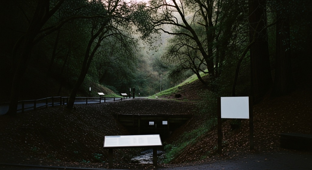
You cannot trek directly onto the mine footprint—it remains fenced-off private property, and the old tunnel mouths are sealed tight under earth and concrete. Instead, hit the York Trail inside Leona Heights Park off McDonell Avenue. You'll hike along second-growth redwoods and oak canopy beside Leona Creek, where the water now runs clear instead of toxic orange. Keep an eye out along the steep canyon walls for telltale rust-colored soil patches and security fencing guarding the capped slope above.
The move: Hike the scenic York Trail in Leona Heights Park, which winds through second-growth redwoods and oak woodlands, and look for the restored Leona Creek.
📍 Before you go The mine is located on private property, fenced off from public trails, and the dangerous tunnels have been permanently sealed and covered during a 2015 environmental remediation project.
- 📍 Oakland
- 💸 Free
- ⚡ Low-key
- 🌗 Outdoors
Where: 5250 McDonell Ave, Oakland, CA 94619, USA
Hours: Added 2026-07-20 — confirm current access before you go.
Pair it with
- Chabot Space & Science Center — Public Telescope Nights — After tracing Oakland's buried subterranean history, drive deeper into the hills to stare into deep space through Chabot's giant historic refractors.
- Chapel of the Chimes — Pair a morning walk along a restored canyon creek with Julia Morgan's sprawling, maze-like indoor columbarium full of skylit courtyards and mosaic fountains.
- California Historical Radio Society / Radio Central Museum — Trade 1900s mining ruins for early 120-year-old electronics technology down in Alameda.
More weird in San Francisco

Good to know
Can you still get inside the mine shafts?
No. The dangerous adits and tunnels were permanently sealed and buried during the 2015 environmental remediation project, and the site itself is fenced private property.
Where do you park to see the area?
Access the public trail network at the end of McDonell Avenue in Oakland, where you can pick up the York Trail into Leona Heights Park.
Why was the creek bright orange for so long?
Exposed iron pyrite tailings reacted with rain and air to create sulfuric acid and dissolved iron. As the acidic water hit oxygenated air in the creek, the iron oxidized and painted the stream bed bright orange.
Is the trail suitable for a casual hike?
Yes, the York Trail is a scenic, moderately easy shaded walk through redwoods and oaks, though it can get muddy and steep in slippery spots near the ravine.
Plan a visit & invite your people →
Further reading: localwiki.org · waterboards.ca.gov · sfgate.com · swrcb.ca.gov
last checked: 2026-07-20