Entry No. 71 — the Fort Collins file — filed under: mine
Deadman Butte Mine
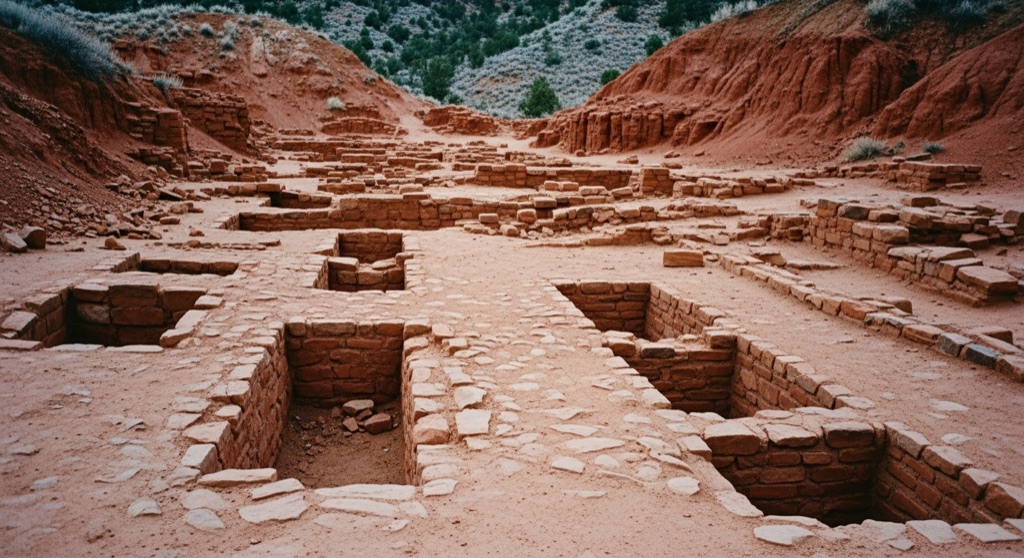
Located near the hamlet of Livermore, the Deadman Butte Mine is a historic gypsum prospect dating back to the early 20th century. First documented in geological surveys around 1920, the site features remnants of old exploratory workings and trenches. Today, the inactive mine sits quietly on the slopes of Deadman Butte, surrounded by rugged northern Colorado terrain.
→ Three more abandoned & forgotten places in Fort Collins — never the same twice
The story
When geological surveyors mapped this corner of Larimer County around 1920, they logged a minor note near the hamlet of Livermore: a gypsum prospect cut into the slopes of Deadman Butte. Prospectors had sliced exploratory trenches into the rock, testing the quality of the industrial mineral bound inside the local red sandstone and limestone formations.
It never turned into a full-scale industrial operation or a deep underground shaft complex. Instead, the prospectors packed up, leaving behind cut ledges and shallow diggings that slowly faded back into the rugged northern Colorado hills. What sits there now is a century-old pocket of forgotten geological trial-and-error, quiet and largely undisturbed.
What it's like
Keep your boots on public ground—the mine site rests on or immediately adjacent to private ranch lands near Deadman Butte, with no public trail access to the old workings. The move here is an optical hunt along Highway 287. Drive up through the Livermore area, pull over safely at a wide roadside turnout, and cut your engine. Bring binoculars or a long lens to scan the red rock cliffs of Deadman Butte for the faint, squared-off cuts and old exploratory trenches left behind a hundred years ago.
The move: Take a scenic drive along Highway 287 to view the striking red sandstone and limestone formations of Deadman Butte, stopping at safe pullouts to photograph the rugged landscape.
📍 Before you go The mine is located on or adjacent to private ranch lands near Deadman Butte, with no confirmed public trails leading directly to the workings.
- 📍 Deadman Butte Mine
- 💸 Free
- ⚡ Low-key
- 🌗 Outdoors
Where: Deadman Butte Mine, Colorado 80536, USA
Hours: Added 2026-07-20 — confirm current access before you go.
Pair it with
- Virginia Dale Overland Trail Stage Station — Continue north up Highway 287 to visit a 1862 Overland Trail stage station built during the same era of high-plains exploration.
- Lindenmeier Paleo Site at Soapstone Prairie — Pair a view of 1920s gypsum prospecting with a trip to one of North America's most significant Folsom-culture archaeological sites nearby.
- Owl Canyon Gliderport — Trade ground-level mineral history for high-plains soaring at a glider airfield operating just east across the prairie.
More weird in Fort Collins

Good to know
Can I hike directly up to the old mine workings?
No. The site sits on or adjacent to private ranch land with no confirmed public trail leading to the trenches. Trespassing is forbidden, so stick to viewing the site from public roads.
What were miners extracting at Deadman Butte Mine?
Geological surveys from around 1920 document it as a historic gypsum prospect, where exploratory trenches were cut to test local mineral deposits.
Where is the best spot to view Deadman Butte?
Along Highway 287 near Livermore, north of Fort Collins. Use safe, established pullouts to photograph and view the striking red sandstone and limestone formations.
Plan a visit & invite your people →
Further reading: ceb.wikipedia.org · mapcarta.com
last checked: 2026-07-20