Entry No. 53 — the Colorado Springs file — filed under: outdoor
Poplar Gulch Trail (from St. Elmo ghost town)
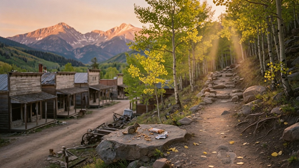
Almost everyone who reaches St. Elmo comes for the ghost town itself — the weathered 1880s storefronts, the chipmunks, the gift shop — and then turns around. Steps from that main street, an unmarked path slips uphill into the trees: 100% singletrack, climbing through aspen groves where the views of the southern Collegiate Peaks open up a little more with every switchback. It's the rare trail that starts inside a preserved mining town and ends in genuine high-altitude wilderness. Most people miss it because the town is the destination. Here, the town is the trailhead, and the silver-mining ruins are just the warm-up to the climb.
→ Three more oddity shops & curiosities in Colorado Springs — never the same twice
The story
St. Elmo is where tourists go to buy store-bought seeds, hand-feed chipmunks, and snap photos of weathered 1880s wooden storefronts [1.2.3]. Nine out of ten visitors park, stroll the main dirt drag, and turn their cars right around down County Road 162. What almost everyone overlooks is that the town isn't just an outdoor museum—it's a launchpad into the San Isabel National Forest. Just past the center of town, across a small wooden bridge and up the rocky lower pitch of Tincup Pass, an unmarked singletrack branches off directly into the trees.
That path is Poplar Gulch Trail #1436. While the crowd down on the street is jostling over rusted mining machinery, this singletrack quietly climbs out of the gulch, cutting through dense stands of aspen and pine along a rushing mountain stream. As you hit the switchbacks, the noise of tourists and idling ATV engines fades. Every quarter-mile opens up increasingly wide, elevated angles on the southern Sawatch Range and the headwaters of Chalk Creek, framing peaks from vantage points the casual sightseers never see.
Because the trail sits inside a multi-use area, you might share the first two-tenths of a mile with an off-road vehicle grinding up toward Tincup Pass, but once the singletrack breaks away, it turns into high-altitude solitude. The hike offers a choose-your-own-effort proposition: a manageable four-mile round trip that tops out in gold-leaf aspen groves at 11,200 feet, or a grueling 12-mile alpine traverse that punches over a 12,276-foot pass into Green Timber Gulch. Either way, you get the rare thrill of stepping out of a preserved silver-boom ghost town and straight into wild mountain wilderness.
What it's like
You'll rumble into St. Elmo on CR 162, push past the chipmunk-feeding crowds, cross the wooden bridge, and head left toward Forest Road 267. Unless you're driving a capable 4WD rig with high clearance, don't attempt the final 0.2-mile rocky climb up Tincup Pass—park in the small pull-off at the bottom and walk up. The lower stretch carries a bit of dust from passing ATVs, but the singletrack quickly breaks away into cool aspen groves and open mountain meadows. Expect a steady climb from 10,100 feet up to roughly 11,200 feet for the standard turnaround spot. There are no restrooms or water sources on the trail, so take care of logistics in town and carry plenty of water. Pack layers and plan to make your summit or turnaround call by midday before afternoon thunderstorms roll over the peaks.
The move: Make the drive the date. Wind up Chalk Creek to St. Elmo, poke around the ghost-town storefronts and feed the famous chipmunks, then peel off onto the singletrack while everyone else heads home. Climb through the aspens at a talking pace, pick a turnaround spot where the peaks open up, and split a snack on a rock above the treeline before heading back down into the 1880s.
📍 Before you go "Poplar Gulch" is really one trail with several stopping points, so pick your effort. The date-doable move is an out-and-back turnaround at about 4.2 miles round trip with roughly 1,284 ft of gain — moderate, climbing from ~10,100 ft into aspens around 11,200 ft. The full trail pushes much farther (~12 miles over a 12,276-ft pass) and is genuinely hard; only commit to that with real fitness and an early start. Getting there: from Nathrop on US-285, CR 162 west ~16 miles to St. Elmo; cross the wooden bridge in town and go ~0.25 mile to the Tincup Pass road (FR 267). The final 0.2 mile to the trailhead is rocky/4WD — park low and walk up if unsure. Best season is roughly June through October; early summer snowpack can make the upper trail impassable, and high-country afternoons brew sudden thunderstorms, so summit-or-turnaround decisions should be made by midday. You're above 11,000 ft — pace for the altitude and carry water (there's none on the trail). Expect ATVs and dirt bikes on the first stretch and around town; this is shared, multi-use country, and mountain goats are sometimes spotted on the ridgeline. It sits in San Isabel National Forest (Salida Ranger District); no fee or permit is required to hike, but parking at the trailhead is limited to just a few vehicles. No facilities on the trail — restrooms and snacks are back in St. Elmo.
- 📍 St. Elmo / Chalk Creek
- 💸 Free
- ⚡ Up for anything
- 🌗 Outdoors
Where: Poplar Gulch / Tincup Pass trailhead, St. Elmo. From Nathrop on US-285, take County Road 162 west about 16 miles to the St. Elmo townsite. Driving through town, turn right over the small wooden bridge, then left and go about 0.25 mile to Forest Road 267 (the Tincup Pass road), which climbs steeply to the trailhead. The last 0.2 mile up Tincup Pass is rocky and 4WD-high-clearance; if you're not in a capable rig, park at the bottom and walk up to the trail.
Hours: Day-use, free. Best season: June through October (early summer snow lingers high; afternoon thunderstorms in mid/late summer). Confirm trail & road conditions before you go.
⚠ Seasonal or scheduled — always check before you go.
Pair it with
- Comanche Drive-In Theatre — After coming off the trail, drive 12 miles down to Buena Vista to catch a film under the stars at America's highest-elevation drive-in theater.
- Petrified Forest Loop at Florissant Fossil Beds National Monument — Swap living high-country aspen groves for 35-million-year-old petrified redwood stumps along a quiet loop trail further east.
- Cripple Creek Wild Donkey Herd — Pair one ghost town's hidden mountain escape with another gold-rush settlement where the feral descendants of 19th-century pack burros freely roam the streets.
More weird in Colorado Springs



Good to know
Do I need a fee or permit to hike Poplar Gulch Trail?
No fees or permits are required. The trail is located within San Isabel National Forest and is open for public day use [1.2.3].
How far is the standard day hike on Poplar Gulch?
The moderate out-and-back option turns around in the aspen meadows at about 2.1 miles in (4.2 miles round trip), gaining roughly 1,284 feet of elevation up to 11,200 feet.
Can my car make it all the way to the trailhead?
Only if you have high clearance and 4WD for the last 0.2-mile stretch of Forest Road 267. Regular passenger cars should park in the small area at the bottom of the Tincup Pass road and walk the remaining distance.
Are there restrooms or drinking water on the trail?
No. There are no facilities or potable water along the trail. Restrooms and snacks are available back in the St. Elmo townsite.
Plan a visit & invite your people →
Further reading: colorfulcolorado.com · hikingproject.com · fs.usda.gov
last checked: 2026-06-10