Entry No. 48 — the Des Moines file — filed under: ghost-town
Buxton Historic Townsite & Cemetery
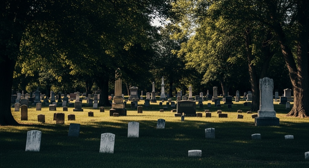
The vanished site of Buxton, a 1900-1920s coal town of ~5,000 that was a rare, thriving racially-integrated community with Black doctors, lawyers, and teachers. Today little remains but an overgrown cemetery and the prairie that swallowed the rest.
→ Three at a time, never the same twice — explore weird Des Moines
The story
In 1900, the Consolidation Coal Company did something almost unheard of in turn-of-the-century America: they carved a boomtown out of Monroe County prairie where Black and white miners earned equal union pay, lived in integrated neighborhoods, and shared civic authority. At its peak, Buxton was a thriving city of 5,000 residents—the largest in the county—where Black doctors, attorneys, teachers, and mine supervisors anchored a community that operated completely outside the strictures of Jim Crow.
When the coal seams ran dry in the 1920s and the railroad moved its equipment, Buxton wasn't left to rot into picturesque ruins. The company systematically dismantled the houses, salvaged the lumber, and pulled up the tracks. Southern Iowa prairie grass swallows fast; within a decade, virtually every physical trace of the town was buried under topsoil.
What remains isn't a classic ghost town with standing false-front saloons and glassless store windows. It is a ghost landscape—a silent patch of rural pasture where thousands once lived and worked, with only historical markers and a tucked-away cemetery left to prove the place ever existed.
What it's like
Set your expectations before making the hour-plus drive south from Des Moines: there are no restrooms, no gift shops, and no standing brick walls out here. You'll navigate rural gravel roads east of Lovilia. The former townsite itself rests on private land enrolled in the Conservation Reserve Program—contact the Monroe County Historical Society if you want permission to step beyond the State Historical Society markers. The cemetery, situated a quarter-mile south of a gravel road through open pasture, is the portion you can explore on your own. Wear real boots and long pants to navigate the high grass and find the scattered, reset headstones of miners and their families. Stock up on fuel and food in Lovilia or Albia before heading out.
The move: Visit in daylight and read the historical markers, then walk to the cemetery a quarter-mile south to find the surviving headstones of the miners and their families.
📍 Before you go This is a rural pilgrimage, not a city stop: the townsite sits east of Lovilia in Monroe County, well over an hour's drive south of Des Moines, and the ruins themselves stand on private land the owner set aside in the Conservation Reserve Program — arrange access through the Monroe County Historical Society rather than walking in cold. The cemetery is the piece you can find on your own, about a quarter-mile south of a gravel road through open pasture; only a scattering of reset headstones survives, so wear real boots and expect uneven, overgrown ground. There are no facilities out here, so handle gas and food in Lovilia or Albia first. Pair it with the Monroe County Historical Society & Museum in Albia (a seasonal, weekends-in-the-warm-months operation) for the Buxton artifacts, then stroll Albia's restored Victorian square.
- 📍 Lovilia (Monroe County)
- 💸 $$
- ⚡ Up for anything
- 🌗 Indoors
Where: East of Lovilia, IA; townsite interpreted by the State Historical Society of Iowa
Hours: Added 2026-06-09 — confirm current hours before you go.
Pair it with
- Ken's - a not so secret speakeasy — After tracing 1920s coal history in Monroe County pasture, head back into Des Moines for drinks in a basement speakeasy named after 1920s bootlegger Kenneth Sonderleiter.
- The Dust Collective — Balance the empty, quiet pasture where Buxton once stood with a stop at this East Village spot filled with curated vintage objects and local oddities.
- Alleged Lee's — Extend your dive into early 20th-century Iowa history back in Des Moines over drinks served behind an ornate 130-year-old carved bar.
More weird in Des Moines


Good to know
Are there any original buildings left standing in Buxton?
No. When the mines closed in the 1920s, the mining company dismantled the houses and infrastructure to reuse or sell the lumber, leaving no standing structures.
Can I walk across the original townsite?
The main townsite ruins sit on private agricultural land enrolled in the Conservation Reserve Program. You can view the area from public roads and read the markers, but you should coordinate with the Monroe County Historical Society before stepping onto private pasture.
How do I reach the Buxton Cemetery?
The cemetery sits roughly a quarter-mile south of the gravel road east of Lovilia. You will be walking through open, unpaved pasture, so wear sturdy footwear for uneven terrain.
Where can I see actual historical artifacts from Buxton?
Head into nearby Albia to visit the Monroe County Historical Society & Museum. They hold Buxton photos and mining tools, operating seasonally on warm-weather weekends.
Plan a visit & invite your people →
Further reading: iamonroe.org · iowaghosttowns.com · Official site
last checked: 2026-06-09