Entry No. 75 — the Coeur d'Alene file — filed under: ruins
Conjecture Mine
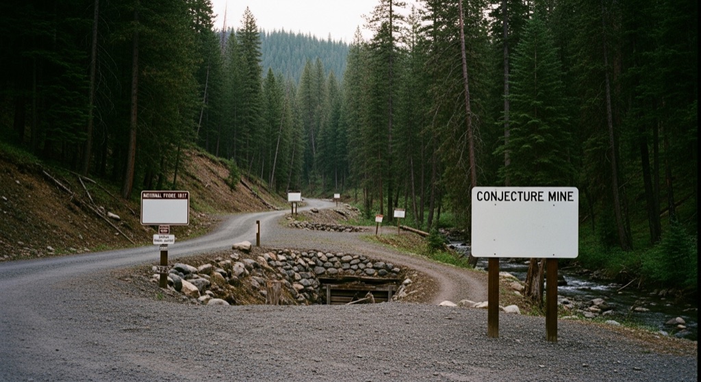
Discovered in 1894, the Conjecture Mine was a historic silver and lead producer in the Lakeview Mining District of northern Idaho. The site once featured a 200-foot inclined shaft and multiple adits, but it underwent extensive EPA and Forest Service cleanup in 2007 to remediate heavy metal contamination. Today, the surrounding area is a quiet, forested landscape along Gold Creek, with the historic mine workings mostly sealed or reclaimed.
→ Three more abandoned & forgotten places in Coeur d'Alene — never the same twice
The story
In 1894, prospectors working the Lakeview Mining District picked open the dirt six miles south of Lakeview and hit high-grade silver and lead along Gold Creek. That discovery became the Conjecture Mine, an underground operation that dug out a 200-foot inclined shaft, three adits, and hundreds of feet of subterranean levels across seven decades of intermittent production before shutting down in 1963. But when the miners packed up, they left behind four massive waste rock dumps and thousands of tons of heavy-metal tailings sitting directly in the Gold Creek drainage.
What makes Conjecture fascinating today isn't just its 19th-century origin, but the secret battle fought over its toxic aftermath. For decades, heavy concentrations of arsenic, lead, and manganese leached into Gold Creek until 2007, when the EPA and US Forest Service moved heavy machinery in to execute a massive remediation project. Federal crews hauled away 31,000 cubic yards of contaminated soil and 2,000 cubic yards of creek bed sediment to a sealed Forest Service repository, capping the waste and reshaping the stream bed. The federal government even fought a corporate legal battle that culminated in a $4.5 million court judgment in 2014 to recoup the cleanup costs. You're walking along ground that literally took a federal lawsuit to scrub clean.
What it's like
When you pull up along National Forest Road 1017, don't expect gaping caverns or open timber portals—the underground workings are strictly sealed, and portions of the claim remain private land. Instead, you'll find a quiet, re-contoured forest landscape along Gold Creek where thick Panhandle timber covers engineered containment mounds and restored stream banks. You can view the terrain legally from public NF Road 1017 or while navigating the adjacent Conjecture Mine OHV trail. Bring a high-clearance vehicle for the unpaved forest roads, stick strictly to public rights-of-way, and enjoy the eerie quiet of standing over a multi-million-dollar heavy-metal containment site.
The move: Take a scenic drive along National Forest Road 1017 and hike or ride the Conjecture Mine OHV trail, enjoying the rugged beauty of the Idaho Panhandle National Forests and spotting the reclaimed areas of this historic mining district.
📍 Before you go The mine site is located on a mix of private property and National Forest System lands, and the underground workings are sealed and dangerous. However, visitors can legally view the reclaimed area from the public NF 1017 Road and the adjacent Conjecture Mine OHV trail.
- 📍 Conjecture Mine
- 💸 Free
- ⚡ Low-key
- 🌗 Outdoors
Where: Conjecture Mine, Idaho 83811, USA
Hours: Added 2026-07-20 — confirm current access before you go.
Pair it with
- Silver Leaf Mine — Hit another quiet underground prospect from the same 1890s Lakeview mining boom just down the dirt road.
- Bellville Mine — Pair two defunct lead and zinc workings nestled inside the same isolated Gold Creek drainage.
- Coeur d'Alene Astronomy Club star parties (Farragut State Park) — Trade daytime heavy-metal mining history for dark night skies down at nearby Farragut State Park.
More weird in Coeur d'Alene



Good to know
Can you go inside the underground shafts at Conjecture Mine?
No. The inclined shaft and adits have been sealed permanently by federal remediation crews to prevent collapse and severe safety hazards.
Is Conjecture Mine located on public land?
It sits on a mix of private patented land and Idaho Panhandle National Forests land. You can view the reclaimed area legally from NF Road 1017 and the public OHV trail.
What was remediated during the 2007 EPA cleanup?
EPA and Forest Service crews excavated roughly 31,000 cubic yards of toxic waste rock soil and 2,000 cubic yards of contaminated stream sediment loaded with lead, arsenic, and manganese.
What road leads to the mine site?
The site is accessed via National Forest Road 1017 (NF 1017), about six miles south of Lakeview in Bonner County.
Plan a visit & invite your people →
Further reading: response.epa.gov · trailforks.com · epa.gov
last checked: 2026-07-20